
Walk an Eustis Street Directory from Address to Evidence
A sound Eustis search separates ownership from occupancy. The Lake County Property Appraiser can identify the assessed owner and the parcel's situs address, while Lake County GIS can place nearby parcels in street order. A deed then documents a conveyance, not who sleeps at the address. Voter data, directories, obituaries, and other dated sources may support residency, but each has limits and a different date.
- Enter one address in the Lake County Property Appraiser Property Search; save the situs, mailing address, alternate key, parcel number, and legal-description clues.
- Open the same location in Lake County GIS, then pan or use rectangle Select to gather the parcels along the desired part of the street.
- Use releasable voter information only as dated support. The personal status form is for a voter checking their own record, not a door-by-door search.
- Follow each instrument or book-and-page reference into the Lake Clerk's deed image and read the parties, dates, and legal description.
- For an older household, consult the Eustis Memorial Library run and inspect each volume for a reverse or criss-cross section before assuming it exists.
The same worksheet should be used for each parcel: record the source access date, preserve blanks, and return to the live official record before publishing a fact. Dynamic parcel data can change.
Lake Property Fields Behind the Eustis Street Directory
The appraiser search and GIS viewer serve different parts of a by-address inquiry. Property Search is the quickest route to the assessed owner and parcel card. GIS is better for building the geographic set. Its broad search modes and map tools are documented in the local research.
The Lake County parcel-detail source shows the field structure used to separate the location from owner correspondence.
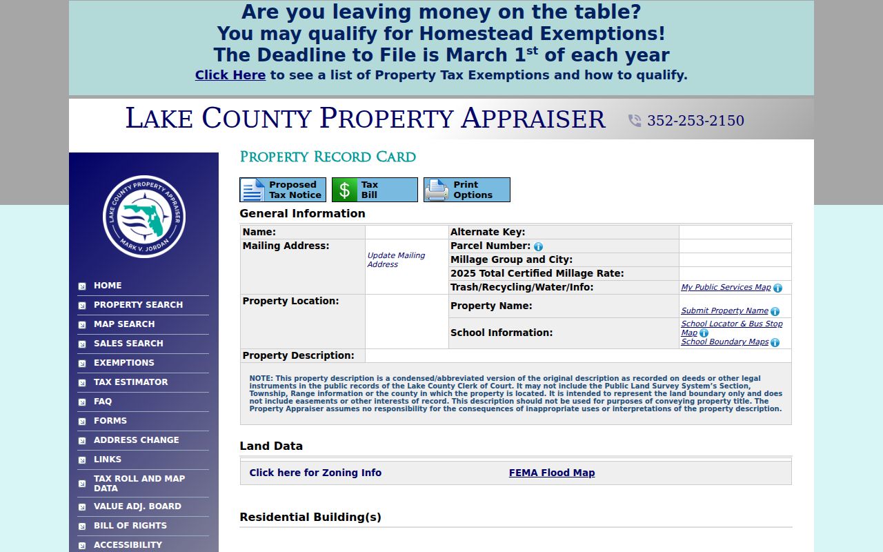
Read the live parcel record after using the captured view because owner, value, exemption, and mailing data can change.
| GIS choice | Input or action | Use in a street search |
|---|---|---|
| Owner Name | Last name then first, no comma | Find mapped parcels tied to an assessed owner |
| Address | Mapped situs text | Anchor the first parcel on an Eustis street |
| AltKey | Numeric text | Carry the appraiser key between systems |
| Parcel Number | Full parcel identifier | Distinguish similar street addresses |
| Subdivision | Autocomplete text | Browse a platted development |
| Select | Draw a rectangle | Return every tax parcel in the chosen area |
| Buffer | Distance in feet plus layer | Expand from one parcel to a custom radius |
GIS results can be downloaded to CSV or Excel. That export is a working list, not a permanent official statement. The verified result fields include owner, owner address, parcel number, parcel address, alternate key, subdivision, lot and block, assessed values, and acreage.
Eustis Situs and Mailing Addresses Answer Different Questions
The parcel card distinguishes Property Location from Mailing Address. Property Location is the situs, the place being assessed. Mailing Address is where tax correspondence goes. A mailing address outside Eustis does not show that the parcel is vacant, and matching addresses do not name other members of a household.
- Parcel
- A mapped unit of land identified by the appraiser's parcel number and alternate key.
- Situs address
- The physical location assigned to the parcel, which may differ from the owner's mailing destination.
- Plat
- A recorded map that organizes a subdivision into blocks, lots, roads, and other dedicated areas.
- Criss-cross directory
- An address-order directory used to move from a street and house number to a listed householder or telephone subscriber.
Use the condensed legal description as a clue, then open the recorded deed for the conveyance language. The parcel card itself warns that its sale history is not a complete chain of title.
Map a Whole Eustis Street with GIS Select
Lake County GIS offers an unusually practical way to build a street directory worksheet. Zoom to the block, draw a rectangle with Select, and use “keep selection active” or “add to selection” when the street extends beyond the first box. The result can then be sorted by street number.
Layers for subdivisions, city limits, voting geography, zoning, permits, and sales add context. Sales filters accept a date range, price range, and heated square footage, although the newest month may not yet be present. Always open the parcel record behind a row before treating an export value as current.
Address-Keyed Records for an Eustis Street Directory
No one database supplies the full Eustis address trail. These sets overlap through the parcel number, legal description, owner name, and normalized street address. Their access channels also differ.
| Address source | Local keeper | Evidence supplied | How to reach it |
|---|---|---|---|
| Property roll | Lake County Property Appraiser | Assessed owner, mailing and situs, parcel facts, exemptions | Free online search after terms acceptance |
| GIS parcel map | Lake County GIS | Street geography, parcels, subdivision and selected layers | Free viewer with CSV or Excel export |
| Deeds and liens | Lake County Clerk Official Records | Named parties, instruments, legal descriptions and images | Free index; office research and mail order fallbacks |
| Permit file | Eustis Building or Lake County Building Services | Applicant, owner, contractor, scope, dates and inspections | GovWell for city parcels; county reports outside |
| Code case | Eustis or Lake County code office | Location, owner, case type, status and open date | City request or county address search |
| Reverse directory | Eustis Memorial Library | Listed householder or subscriber at an old address | Local History Room; inspect each volume |
| Voter file | Lake County Supervisor of Elections | Released registration and precinct fields | Request current format and cost; exemptions apply |
When the web index is not enough, call Lake Official Records at 352-253-2600, use the clerk's order form by mail, or research at 550 W. Main Street in Tavares. Municipal files may be requested by email, phone, mail, or in person through the Eustis City Clerk.
Follow Eustis Deeds Beyond the Appraiser Sale List
After the parcel card supplies an instrument or book and page, open the Lake Official Records image. Read grantor, grantee, execution and recording dates, consideration, and legal description. Then search the seller as an earlier buyer. The portal expects names in LAST FIRST order without a comma and the clerk recommends spelling variants.
Lake's typed coverage reaches deeds back to August 5, 1887, Official Records to January 1, 1957, and plats to October 11, 1884. Older images or exact pages can be obtained from the research room or by the Official Records Order form. Official-record images follow a 300-DPI scanning standard, a useful local detail when faint instruments need close reading.
Do not mistake a shortcut for title history. The appraiser's sale list is a finding aid. Mortgages, probate deeds, certificates of title, and entity transfers can break a simple buyer-to-seller sequence.
City Limits Route Every Eustis Permit Search
A postal Eustis address, especially in 32736, can sit outside municipal limits. Confirm the city-limit layer before choosing a permit keeper. Inside the city, Eustis moved permitting and inspection work to GovWell on May 19, 2025. Guest Access supports permit viewing; account functions handle applications, payments, status, and inspection scheduling.
For unincorporated Eustis addresses, Lake County permit reports search by address, owner, contractor, alternate key, dates, and permit type. County code cases can be searched by address, owner, status, dates, and case number. Older municipal evidence or details absent online should go through a narrow City Clerk request with the address, date range, and record type.
Bridge Old Eustis Addresses with Plats and Maps
Modern street text is not always stable across Eustis history. A rural route may have become a numbered street, an annexed parcel may have changed record keepers, and an older street name may differ from today's GIS label. Keep the subdivision, lot, block, legal description, and parcel geometry in view while comparing sources.
The city's official addressing method uses a one-tenth-mile grid. Historic Sanborn sheets for 1890, 1895, 1901, 1906, 1912, 1917, and 1922 show street names, building footprints, uses, and materials, but not occupants. For named past householders, consult the full Eustis city directory collection rather than extending a modern parcel list backward without support.
Owner and Occupant Clues Along an Eustis Street
Homestead is useful evidence that an assessed owner may occupy a parcel, but it still does not name every person there. A deed documents title activity. A permit links people or firms to work. A voter record supports registration at a releasable address on a dated roll, while directory coverage reflects a publisher's canvass.
Florida's personal voter-status form needs a first name, last name, birth date, agreement checkbox, and CAPTCHA. It is not the street-browse tool. For lawful research involving a public extract, ask the Lake County Supervisor of Elections at 352-343-9734 for the current request form, format, and cost. Protected addresses and confidential identifiers remain withheld.
Limits of an Eustis Street Directory Search
An Eustis street directory cannot reliably list every renter, child, roomer, visitor, or other household member. Driver-record addresses are restricted, protected voter addresses are withheld, and some utility information is exempt. A missing name therefore proves very little. Address Confidentiality Program participants and eligible occupational groups may be intentionally absent or masked.
Use the method to understand a parcel, trace a family address, examine a deed chain, or solve a benign history question. Do not publish a reconstructed door-by-door roster. Confirm any important claim with the office that created the record and retain the date of the source.
Lawful use. Open address records are for lawful personal and civic research. Florida stalking law can apply when location information is used to threaten, repeatedly follow, harass, or intimidate someone.